Ši programa sutaupys Jums daugybę laiko norint sutvarkyti nuotraukas kompiuteryje. Jos pagalba galėsite kiekviena nuotraukai priskirti duomenis, kur ji buvo daryta.
English:
This application will save you lots of time and energy in managing your favorite pictures.
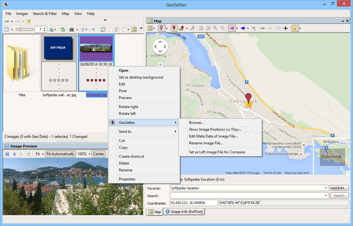
GeoSetter is a freeware tool for showing and changing geo data of image files (e.g. images taken by digital cameras). All you need to do is open them and specify their location.
Here are some key features of „GeoSetter“:
· Reads and writes the formats JPEG and TIFF as well as camera RAW formats DNG (Adobe), CRW and CR2 (Canon), NEF (Nikon), MRW (Konica Minolta), PEF (Pentax), ORF (Olympus) and RAF (Fujifilm)
· Uses ExifTool from Phil Harvey for writing data
· Shows existing geo coordinates and tracks on embedded Google Maps map (requires internet connection)
· Setting geo data by using embedded Google Maps map (requires internet connection) or by entering known values for coordinates and altitude directly
· Automatic filling of location IPTC fields and altitude values (requires internet connection)
· Editable IPTC data (IPTC-NAA/XMP)
· Possibilty to change taken date of images
· Synchronization with track files (NMEA, GPX, PLT and Sony LOG)
· Synchronization with already geo tagged images with buddy images (e.g. between RAW images and their corresponding JPEG images)
· Localizable user interface – English, German, French, Italian, Swedish, Czech, Spanish and Russian language is available at the moment


